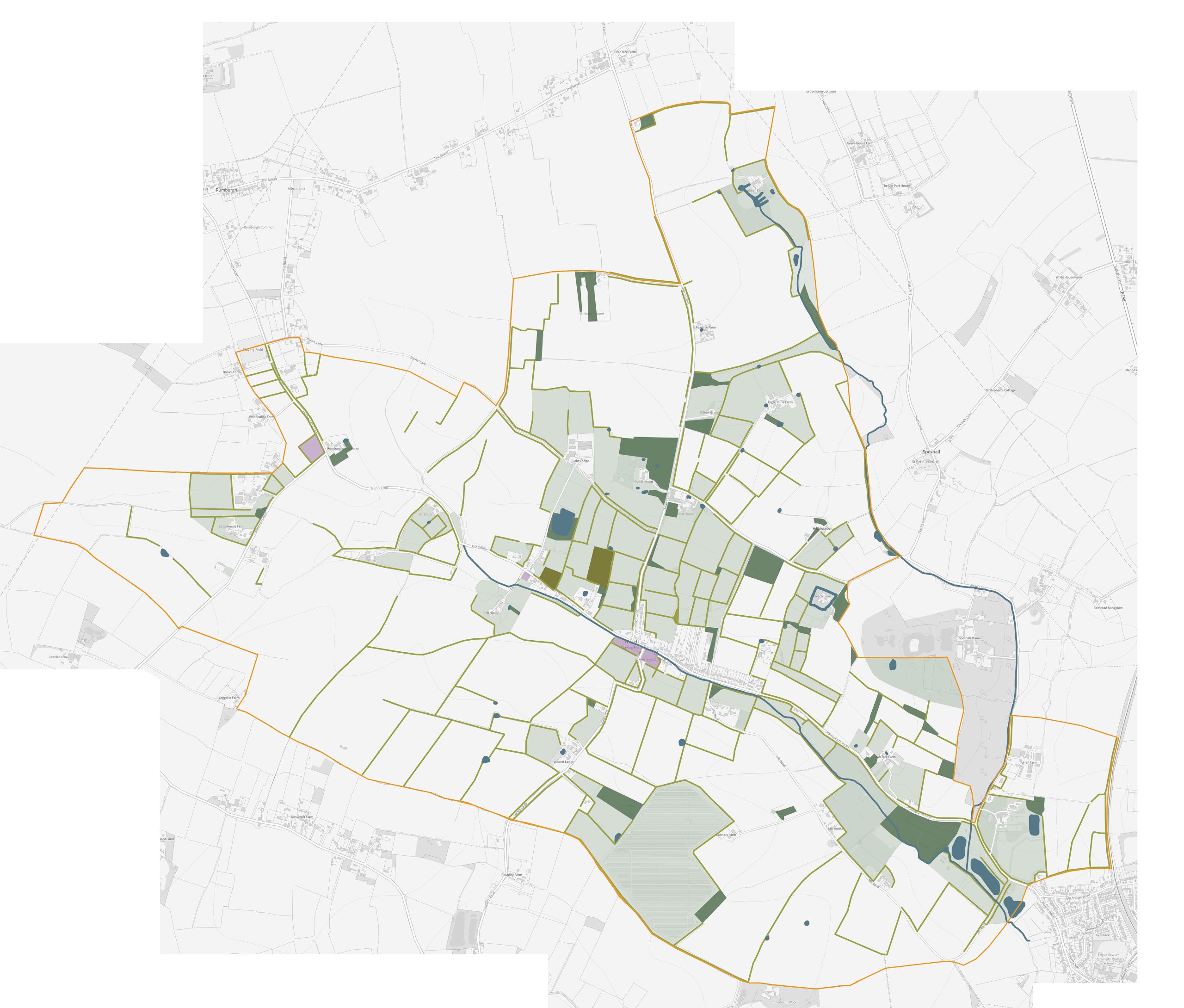
The above identifies existing habitats that we have mapped in the village. It will be an evolving map and updated regularly based on new records being submitted and through the local community working group carrying out positive management of the land within the parish.
The expanse of white represents large, open and intensively farmed land which we hope to work with local landowners to create habitat corridors to link with existing habitats and adjacent parishes